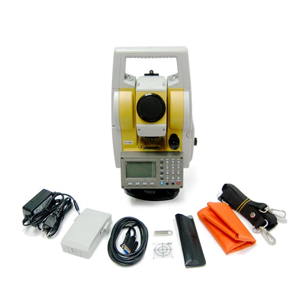
Electronic Total Station
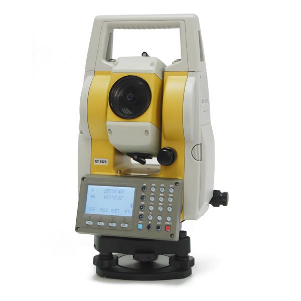
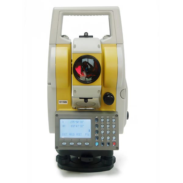
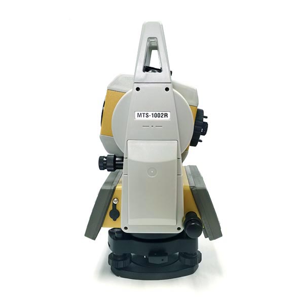
Model MTS-1002R
Features:
Powerful EDM, fast & accurate.
600m reflectorless measuring range & 5km range by single prism
Advanced angle accuracy and dual axis electronic compensation
Bluetooth communication & USB slot for easy data input & output
Visible red laser plummet (optional optical plummet)
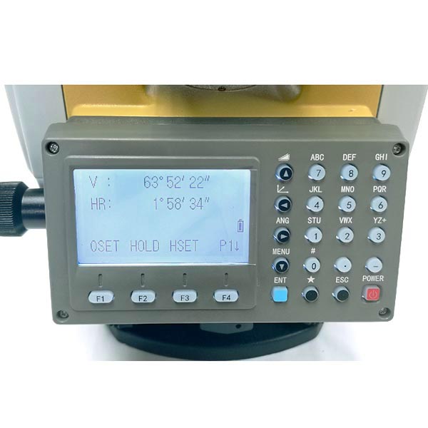
Dual large LCD display for face left/right measurement
Topcon Operation System, compatible with Topcon program & software
Optional English or Spanish operation system menu
Alphanumeric keypad for quick entering of letters and numbers
Rugged & Waterproof design
Integrated construction and survey software:
Coordinate measuring, Setting out points, Resection, Missing line measurement,
Offset point, Remote elevation measurement, Area calculation, Angle repetition,
Set out line, Set out curve, Set out road
Standard Set:
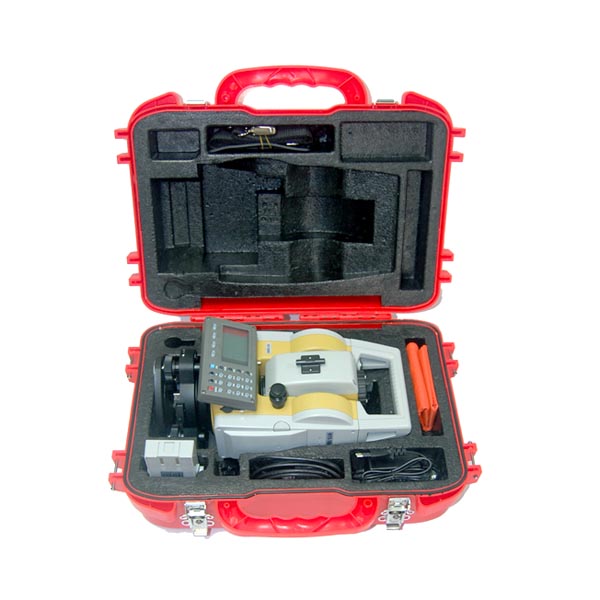
Total station, 2 rechargeable batteries, charger, download software CD, tool Kit, English manual, plastic carry case.
Optional Accessories: Data Download Cable, USB Flash Disk
Operation system language: English, Spanish (Optional)
Colors available: Yellow/Grey
Ordering Information:
Model | MTS-1002R |
Brand | GeoTech, Neutral Packaging or Customer’s brand |
Place of origin | Made in China |
M.O.Q. | 1unit |
Lead time | 7-10 work days |
Payment terms | T/T, Paypal |
Shipping terms | EXW, FOB, CFR, CIF,DDU |
Shipping method | Courier, air, sea |
Place of delivery | Worldwide |
Packaging | 1unit/box, 1box/carton |
Free sample service | No. |
Customized service | Yes. See below. |
private label/logo printing | Instrument, carry case (MOQ:20units) |
Inner box, outer carton (MOQ:20units) |
User’s manual, black/white only (MOQ:20units) |
appearance color | Yellow/black, Yellow/Grey (No MOQ) |
Customer’s color (MOQ:50units) |
mechanical assembly | 360 degree or 400gon scale (No MOQ) |
5/8” or Metric tripod connecting thread (No MOQ) |
optical System | No |
Electronic/Software | English, Spanish menu (No MOQ). Other languages menu (50units) Private brand name in operation system (50units) |
Model | MTS-1002R |
Reflectorless measuring range | 600m |
Measuring range with single prism | 5km |
Internal Memory | 40000 Points |
Blue tooth connection | Yes |
Telescope |
|
Image | Upright |
Objective aperture | 45 mm |
Magnification | 30 x |
Field of view | 1° 30’ |
Resolving power | 4’’ |
Shortest focus distance | 1.5 m |
Distance measurement |
|
Accuracy | 2 mm + 2 ppm |
Measuring time (Fine/Rapid/Tracking) | 1.0s / 0.7s / 0.3s |
Minimum reading | 1 mm |
Distance units | m / ft |
Angle measurement |
|
Minimum reading resolution | 1’’ / 5’’ / 10’’ |
Angle accuracy | 2’’ |
Angle units | 100 % / 360° / 400 gon |
Compensator | Dual Axis, Electronic Type |
Range | ± 3° |
Display |
|
Dual LCD | Dual Display, illuminated |
Laser plummet |
|
Accuracy | ± 1.5 mm / 1.5 m |
Laser classification | Class II, red laser |
Power Supply |
|
Rechargeable battery type | 7.2 V DC NiMH |
Operating time (Distance + Angle) | 6h |
Charger | 100 / 240 V |
Vial sensitivity |
|
Plate level vial | 30’’ / 2 mm |
Circular vial | 8’ / 2 mm |
Others |
|
Operating temperature | -20 °C - +50 °C |
IP-Class | IP 55 |
I/O-Port | RS-232, Bluetooth, USB |
Weight | 6.5 kg |
* All specifications & design are subject to change without prior notification.
What is an electronic total station used for?
An electronic total station (ETS) is a versatile instrument used in surveying, construction, and civil engineering to measure and record precise spatial data. It combines the functions of an electronic theodolite and an electronic distance meter (EDM) into one device, enabling it to perform a range of tasks. Here’s a breakdown of its primary uses:
**1. Surveying
Land Surveying: ETS is used to measure land boundaries, create topographic maps, and record elevation changes. It provides accurate horizontal and vertical angle measurements along with distance data.
Construction Layout: In construction projects, it helps in setting out the exact positions of structures, roads, and other elements according to the design plans. This ensures that everything is built in the correct location and alignment.
**2. Mapping
Topographic Mapping: ETS is employed to capture detailed topographic data, which is used to create detailed maps of terrains and landscapes. This is crucial for planning and design in various projects.
Geographical Data Collection: For environmental studies or land management, ETS helps collect accurate geographical data.
**3. Engineering
Structural Monitoring: It is used to monitor the deformation or movement of structures over time, such as bridges, dams, and buildings. This helps in assessing the stability and safety of these structures.
Alignment and Positioning: In engineering projects, ETS ensures precise alignment and positioning of components, such as when erecting columns, beams, or other critical structural elements.
**4. Construction
As-Built Surveys: ETS is used to compare the actual construction with the design plans, ensuring that the project is built according to specifications.
Volume Calculations: It helps in calculating volumes for excavation, grading, and other earthworks by measuring the dimensions of the area being worked on.
**5. Cadastre
Property Boundaries: ETS is used in cadastral surveys to define and document property boundaries, which is essential for legal purposes and land transactions.
**6. Geodetic Surveying
Geodetic Control Networks: ETS plays a role in establishing and maintaining geodetic control networks, which are used for large-scale mapping and spatial referencing.
Features of Electronic Total Stations
Electronic Distance Measurement (EDM): Provides precise distance measurements between the instrument and a target point.
Angular Measurement: Measures both horizontal and vertical angles with high accuracy.
Data Recording and Storage: Stores measurement data, which can be used for further analysis or reporting.
Integrated GPS/GNSS: Some models come with integrated GPS or GNSS capabilities for enhanced positioning accuracy and data collection.
Communication Interfaces: Includes options for data transfer and integration with other software or devices.
Laser Plummet: A laser plummet or optical plummet aids in precise instrument setup and alignment.
In summary, an electronic total station is a crucial tool for a wide range of applications requiring precise spatial measurements and data collection. Its ability to integrate multiple measurement functions into one device makes it a valuable asset in surveying, construction, and engineering projects.
